Using Geo Mapping to Alter the Bank – CSO Political Landscape
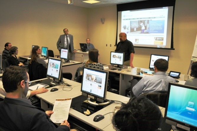
Photo: Civil Society Team
Can the sharing of technical mapping tools and datasets help to change longstanding political relations? This is exactly what’s happening between the World Bank and some of its longstanding advocacy CSO interlocutors. Several recent training sessions and technical workshops co-organized with CSOs on the Bank’s open data tools, are leading to increased collaboration around a common transparency and accountability agenda.
One example is a hands-on training workshop co-organized by the World Bank and the Bank Information Center (BIC) on the Bank’s Open Development Programs on March 7, 2012. Some 20 representatives of well known policy advocacy CSOs from the Washington area (see photo) participated in the two-hour session which featured presentations on a number of Bank data platforms and search tools: Projects and Operations, Open Data, Mapping for Results, and Open Finances. With individual computers stations and Internet access, participants were able to carry out individualized exercises and interactive tutorials. Building on the positive feedback received from this session, an extended 4-hour training session was held during the Spring Meetings on April 18. Some 25 CSO and Youth leaders from developing countries participated in this second session. (see Summary)
A more recent event was a half-day workshop on disaster relief mapping tools co-organized by the Bank’s Global Facility for Disaster Reduction and Recovery (GFDRR) and InterAction on May 3. Almost 200 people from more than 70 organizations participated in the Mapping for Disasters and Development event to discuss free and open source GIS mapping tools. A number of organizations such as Institutionalizing GIS, American Red Cross, and OpenStreetMap, gave talks and hands-on demonstrations on mapping projects being carried out in such countries as Haiti, Kenya, and Indonesia. Suzanne Kindervatter (InterAction Vice President for Strategic Impact) stated in her opening remarks that: “At its heart, mapping is about openness. Openness is critical for inclusive development and a thriving civil society. In order for citizens to shape their own development, they need information on development activities, and spending by donors, as well as what their own governments are doing”.
The most intriguing aspect of these collaborative training efforts on open data tools is that they not only involve service provision CSOs interested in practical mapping applications, but policy advocacy CSOs which are frequently critical of the Bank’s policies and practices. After having campaigned over many years for the Bank to open its data, these CSOs are now attempting to become familiar with the newly available specific datasets and tools. The treasure throve of data now available includes extensive background documents on more than 10,000 projects in the Bank’s projects database, Bank budget information dating back to 1947, and detailed country maps juxtaposing the location of Bank-financed projects with a variety of color-coded poverty data.
Learning how to access this data will not only allow advocacy CSOs to better inform their policy advocacy campaigns going forward, but also share this knowledge and expertise with developing country CSOs and stakeholders who need this information the most. Much like the innovative program Check my School in the Philippines, providing real time information on program goals, project budgets, and disbursement schedules can empower citizens to demand better public services in their communities. This technical collaboration over data should not come as a surprise, however, as advocacy CSOs have worked closely with the Bank over the past several years to consult on and launch its Access to Information policy. By helping to train local citizens groups to access project information and data, advocacy CSOs are now helping the Bank to implement its open development policies.